
How to reach Thirunelli
Thirunelli village relatively isolated and located right in the middle of a forest range. It's located about 32km north of Mananthavady, a major town in Wayanad.
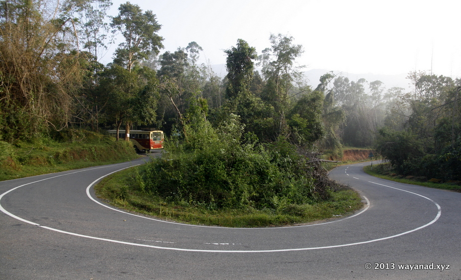
The curvy road to Thirunelli
KSRTC bus negotiating the curvy road to Thirunelli
T
ake the road towards Kattikulam (about 10km from Mananthavady Town). Immediately after crossing the Kattikulam town, take the left diversion. The road will soon wiggle through coffee and teak plantations. About 10km from Kattikulam, you will hit a Y fork. The straight road (main road) goes to Tholpetty Wildlife Sanctuary , Kerala-Karnataka border and Kutta. Take the left of the Y fork. This road is called Thetturoad, that finally end at Thirunelli, mid way you'll cross a small village called Appapara. Beware of elephant herds on this road. Keep distance, they will drift away.Those coming from Bavali or Kuruva Island side, take the above diversion at Kattikulam and continue to Thirunelli.
If you are traveling by public transport, there are frequent local bus services from Mananthavadi during daytime.
KSRTC & Private Buses to Thirunelli:
For those coming from long distances, Kalpetta, Sulthan Bathery and Mananthavadi are major connection points to take bus to Thirunelli.
Popular road routes to Thirunelli:
Bangalore to Thirunelli : Bangalore - Mysore - Hunsur –Nagarhole (road closed in night) - Kutta - Thirunelli
Bangalore to Thirunelli : - Mysore - Handpost (HD Kote) - Bavali (road closed in night) - Kattikulam – Thirunelli (this is the prefered route from Bangalore side. See also Bangalore to Thirunelli)
Madikeri - Gonikoppal - Kutta - Thirunelli
Sulthan Bathery - Beenachi - Kenichira - Nadavayal - Panamaram - Mananthavady - Thirunelli.
Calicut - Kalpetta - Panamaram - Valliyoorkavu - Mananthavady - Thirunelli.
Calicut - Kalpetta - Panamaram - 4th mile- Mananthavadi - Thirunelli
Kannur - Koothuparamba - Nedumpoil - Periya - Mananthavadi - Thirunelli
Location of Thirunelli in Wayanad
Location of Thirunelli in Wayanad
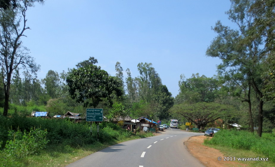
The diversion to Thirunelli is located between Kattikulam and Kutta on the Mananthavadi to Kutta road.
The "Thetturoad" (road towards left at the junction seen) to Thirunelli goes through the wildlife reserve
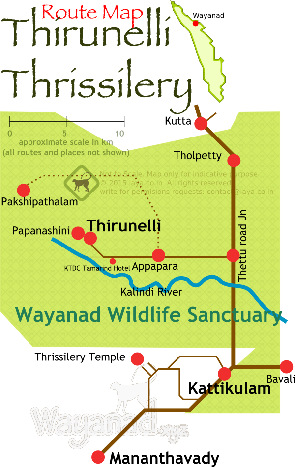
Road Route map for Thirunelli and Thrissilery in Wayanad.
Pakshipathalam is reachable only through trek (permission required) in the forest. Papanashini is a short trek from the Thirunelli temple.
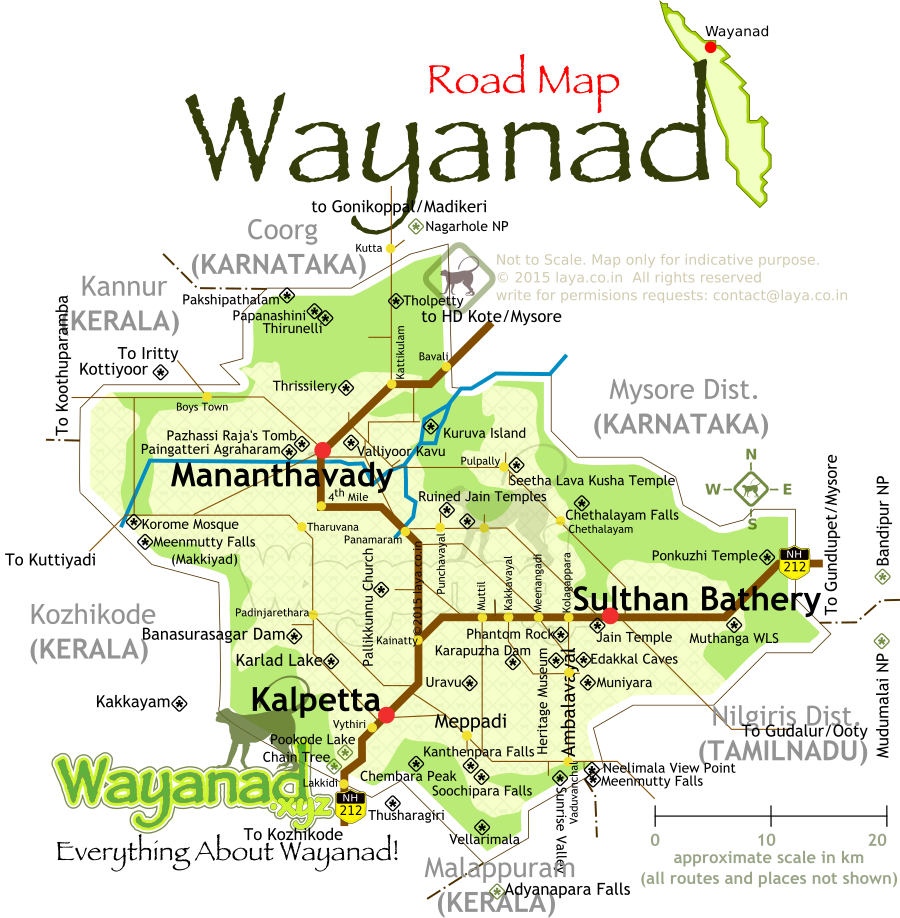
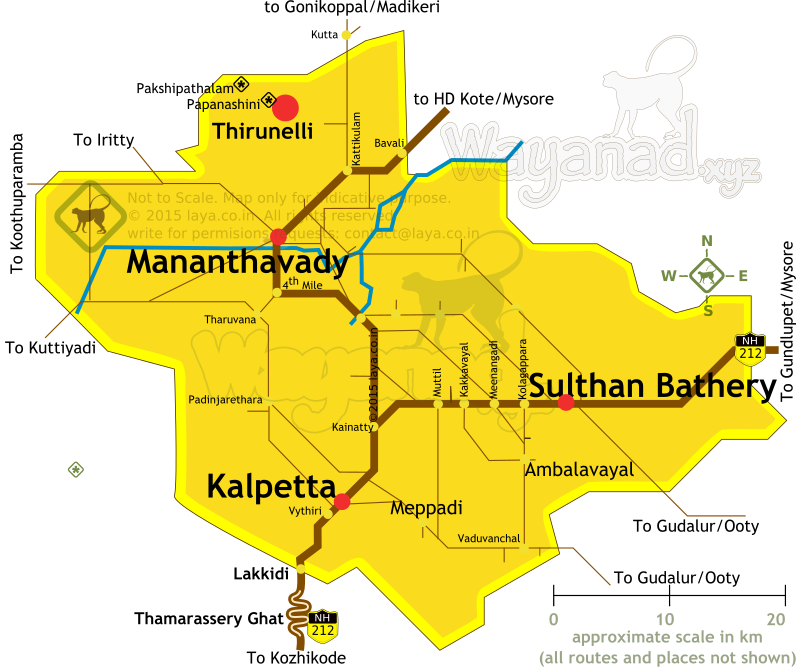
Wayanad District road map for the main tourist circuits.
Major highways and routes to reach the popular tourist attractions in Wayanad is listed in the map.
Location of Thirunelli in Wayanad
The diversion to Thirunelli is located between Kattikulam and Kutta on the Mananthavadi to Kutta road.
Thirunelli Road
The "Thetturoad" (road towards left at the junction seen) to Thirunelli goes through the wildlife reserve
Road Route map for Thirunelli and Thrissilery in Wayanad.
Road Routes to Thirunelli and Thrissilery
Pakshipathalam is reachable only through trek (permission required) in the forest. Papanashini is a short trek from the Thirunelli temple.
Wayanad District road map for the main tourist circuits.
Wayanad Tourism Road Map
Major highways and routes to reach the popular tourist attractions in Wayanad is listed in the map.